Interactive map of this section


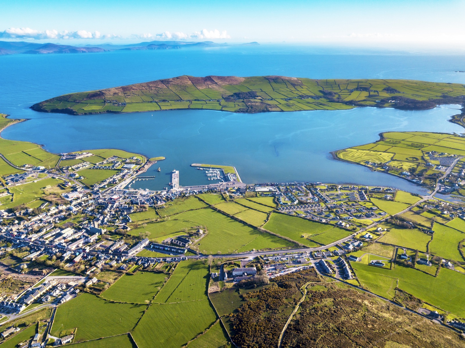
Dingle
Food and Beverage
https://dingle-peninsula.ie/
Toilets
Public Toilets
Bus Details (Local Link)
click more information.

Glanfahan
Nearby
Hold a baby lamb
Beehive Huts
Famine Cottage
Pre Historic Fort 500BC

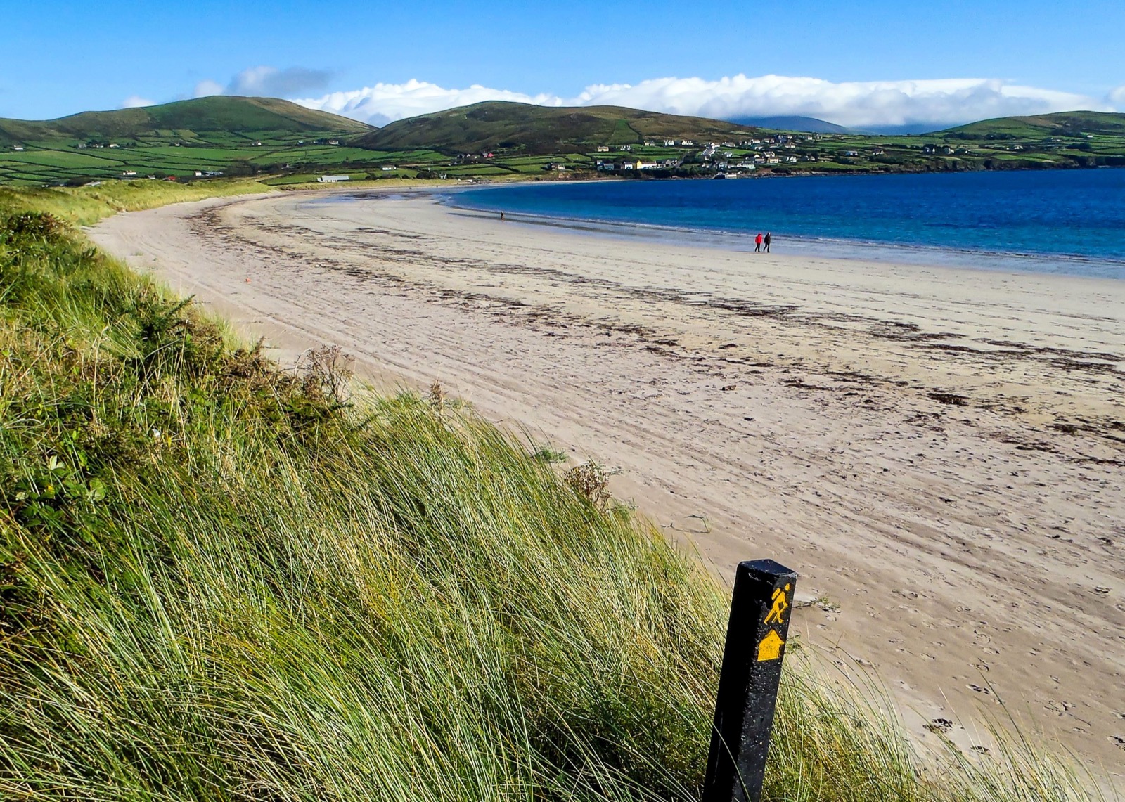
Ventry
Food and Beverage
Quinn's Fish
Paidi O'Shea's
Toilets
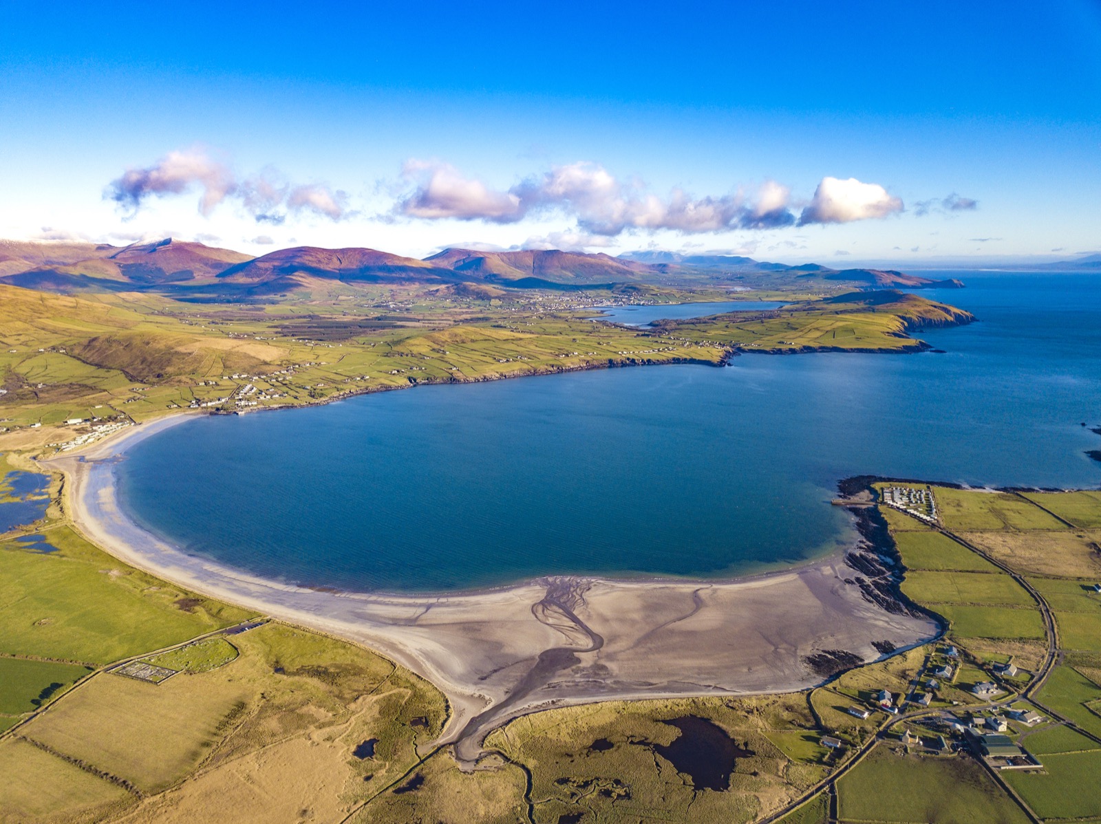
Ventry Beach
Paidi O'Shea's
Quinns bar
Post Office
Cash machine and mailing.
Accommodation
The Plough Ventry
Bus Details (Local Link)
click more information.

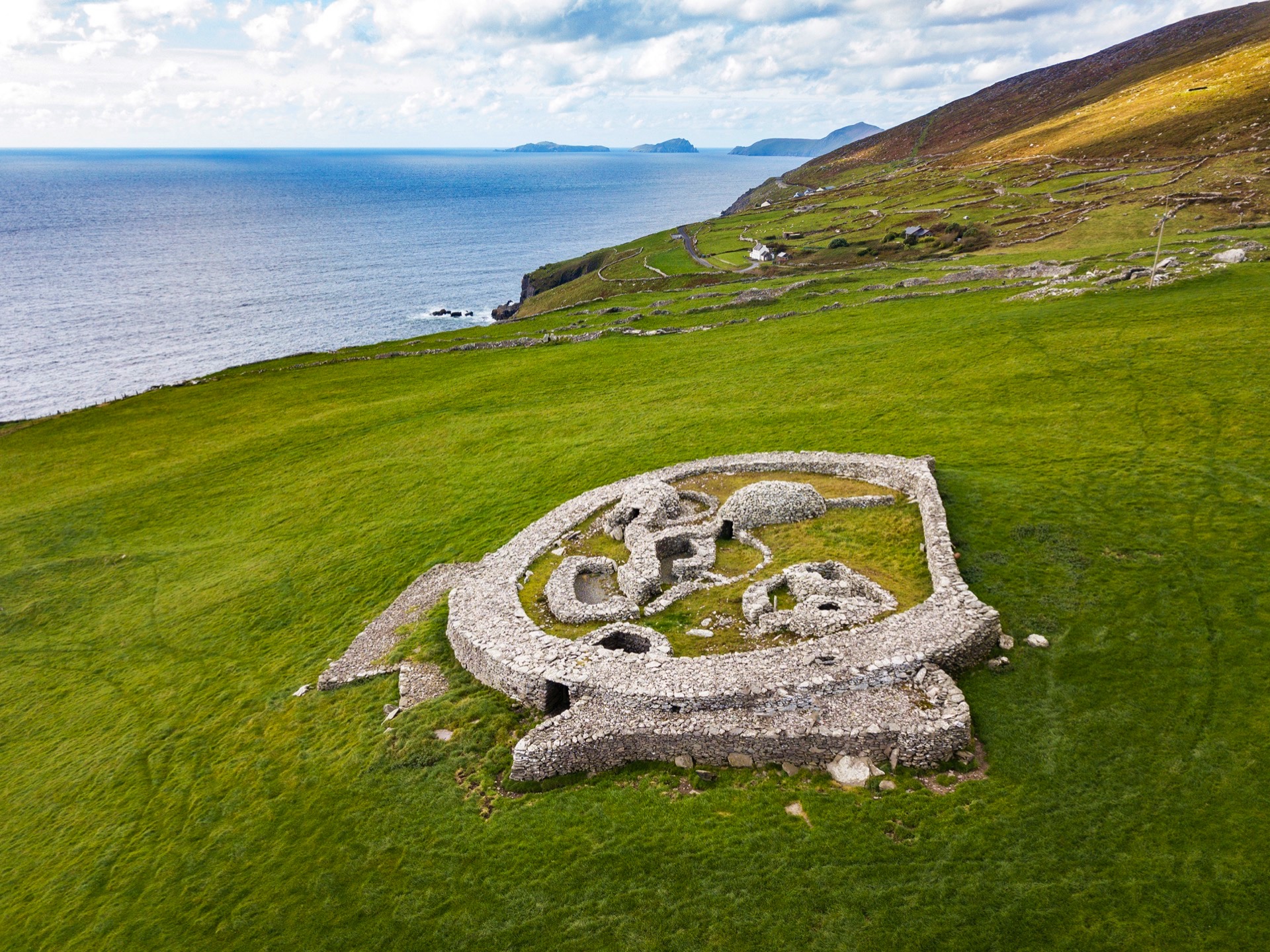
Pre Historic Ring Fort
This roadside archeologial site is a quick and fascinating stop on the dingle way, offering both a glimpse into ancient rural life and sweeping views of the Atlantic and Blasket Islands.
Food and Beverage
Tile Cafe
Dobeys Crab Food
Stone House
Toilets
Tile Cafe
Stone House
Bus Details (Local Link)
click more information.

Coumeenole Beach
Food and Beverage
Teac Couminole Café
Toilets
Teac Couminole Café
(If using restrooms a purchase would be appreciated if possible)
Bus Details (Local Link)
click more information.

Dunquin Peir
Food and Beverage
Cupán Sé
Tig Aine
Bus Details (Local Link)
click more information.
Description

Travelling west along the harbour, the Dingle Way crosses the bridge over the Milltown River. On the right is Dingle Distillery, Ireland’s first purpose built distillery in over 100 years. Across the harbour you can see Esk Hill on which a tower was built in 1847 and among the trees, Burnham House, the former residence of Lord Ventry which now operates as a boarding school. A collection of Ogham Stones are on display on the roadway leading into the school.

After following some intertwining minor roads and tracks for 2km the Dingle Way then meets the main Slea Head Road. Extreme caution must be taken when walking along this section of the road as it is quite a popular scenic drive and there are no banks on either side to climb and allow room for passing traffic

The last part of this stage of the Dingle Way finds the trail back on the main Slea Head road in Dún Chaoin for 3km passing the graveyard where Peig Sayers of Blasket Island fame rests before descending towards a picturesque pier which offers visitors trips to the Blasket Island. A stone plaque at the top of the cliff commemorates the sinking of the Santa Maria de la Rosa of the Spanish Armada in 1588. The continuation of the trail ahead leads to Ionad an Blascaoid, a heritage centre, where the full poignant story of the Blasket Islands can be heard.
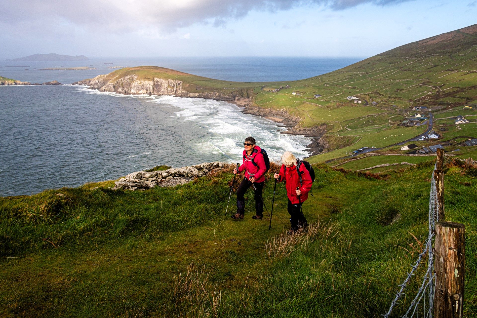
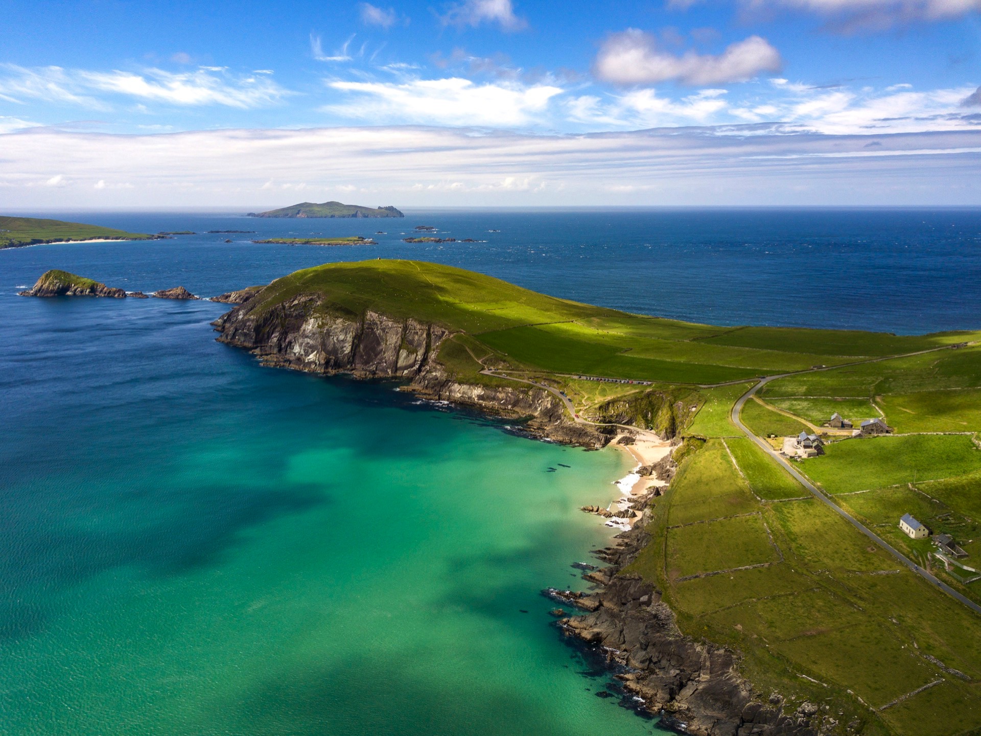
Route Images